
PlaceFinder


HOME /
Murray River, a village, is located in Kings County in the eastern portion of Prince Edward Island, E. of Belfast. Its precise location is N 46°01', W 62°37'.
This page is a comprehensive index of all of the information on our website related to Murray River. You can also search for information on other communities.
| Municipal Government Information |
The Municipality was incorporated in 1955 and has a population of 334.
| Telephone: | (902) 962-2820 |
| Facsimile: | (902) 962-3671 |
| Address: | PO Box 266, Murray River, PE, C0A 1W0 |
| Meetings: | Second Tuesday of the month. This information is subject to change. Please contact the municipality to confirm the meeting time and location. |
| Office Hours: | No fixed hours. |
| Email: | mrvillage@bellaliant.net |
| Website: | http://www.murrayriverpei.com |
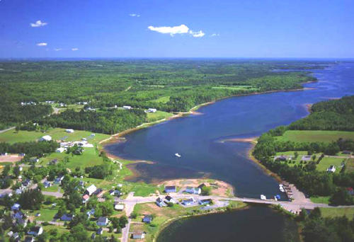
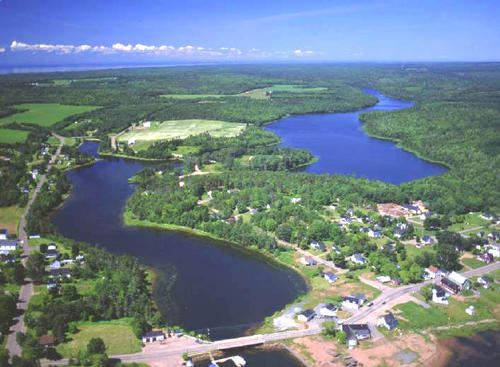
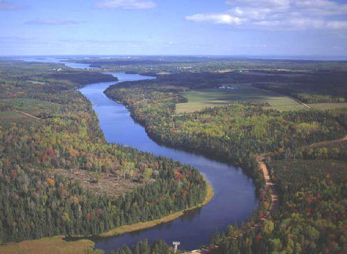
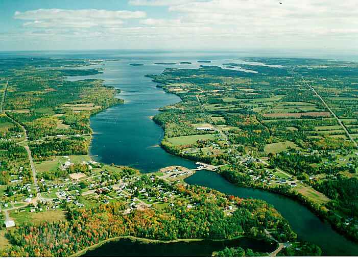
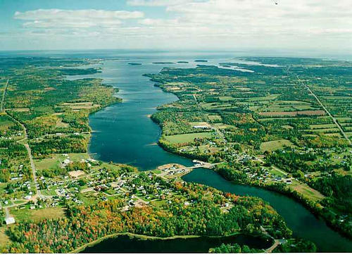
| Aerial Photographs |
Aerial photography courtesy of AirScapes. All aerial photographs are available for sale, as prints or slides; please contact AirScapes for details. You can also see a complete list of aerial photographs of the Island.
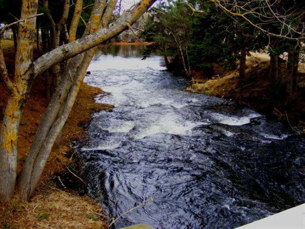
 | Harbour 500 x 342 - 42K 708 x 485 - 59K |  | MacLure's Pond 500 x 367 - 51K 708 x 520 - 73K |
 | MacLures Pond 500 x 367 - 43K 708 x 520 - 64K |  | Murray River 701 x 508 - 55K 500 x 362 - 61K |
MORE AERIAL PHOTOGRAPHS... there are 7 aerial photographs of Murray River in our Aerial Photo Gallery.
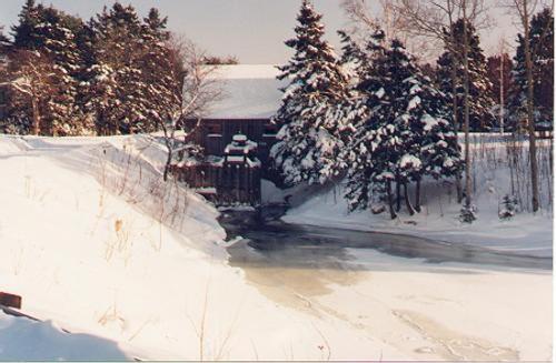
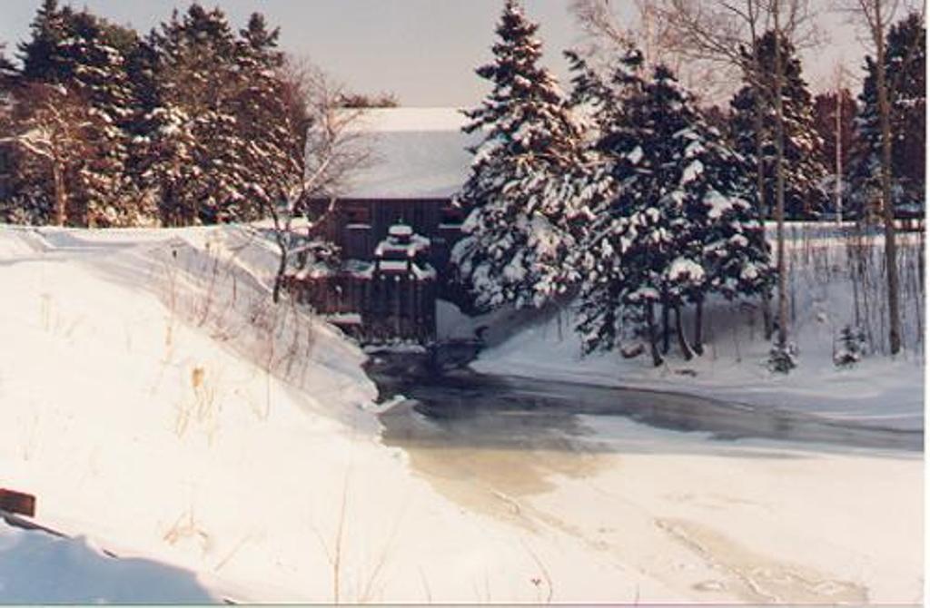
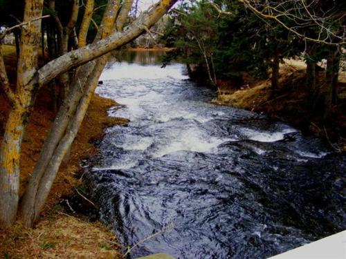
| Community Photographs |
Our community photographs collection includes selected photos of schools, churches, parks, and other public buildings, areas and events. .
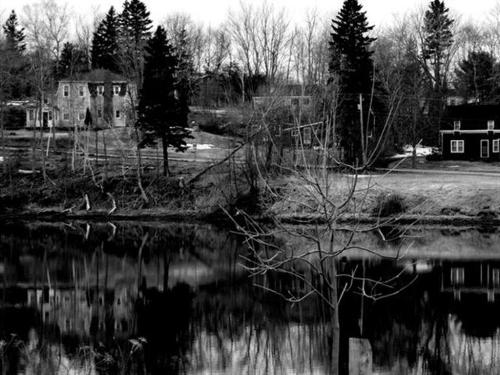
 | The old grist and shingle, water powered from Strickland's dam that operated for many years. The building is still standing today. Credit: (C) 2000 Edison Horton 500 x 327 - 35K 1024 x 670 - 91K |  | MacLure Dam area (fall) Credit: 2010 Daniel Scott 500 x 375 - 45K 1024 x 768 - 130K |
 | MacLure Dam area (spring) Credit: 2010 Daniel Scott 500 x 375 - 42K 1024 x 768 - 119K |
| Visitors Guide Listings |
Our Visitors Guide is a complete vacation planning manual.
| The Geography of Murray River |
Maps
You can use our interactive maps to
display maps of Murray River and area.
Click on the map link:
Show Map
| Statistical Information |
The PEI Community Accounts has information about Murray River. Community Accounts provides a comprensive source of community, regional, and provincial data on social, environmental and economic topics
Information courtesy of Community Accounts
Murray River falls inside the Statistics Canada
census subdivision of Murray River. They have detailed statistical information available
for the Murray River census subdivision for the following categories:
Education,Ethnicity,Family,Income,Labour Force,Population, and Shelter.
Information courtesy Statistics Canada.
| History of the Name |
The official history of the geographic name Murray River (which can be somewhat technical, we admit):
Murray River (Sett.) was adopted in Place Names of PEI, 1925. Confirmed 25 April 1946 on 11L/2, 8 November 1948 on C.4404 and 7 July 1949 on C.4420.Incorporated as a Village in 1955.Status changed to Community by the Municipalities Act in 1983.
Information courtesy Geomatics Canada .