
PlaceFinder


HOME /
Malpeque, an unincorporated area, is located in Prince County in the western portion of Prince Edward Island, NW. of Kensington. Its precise location is N 46°32', W 63°41'.
This page is a comprehensive index of all of the information on our website related to Malpeque. You can also search for information on other communities.
| Aerial Photographs |
Aerial photography courtesy of AirScapes. All aerial photographs are available for sale, as prints or slides; please contact AirScapes for details. You can also see a complete list of aerial photographs of the Island.
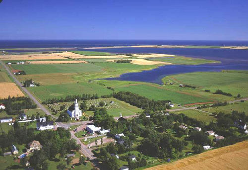
 | Malpeque United Church 500 x 342 - 43K 708 x 485 - 67K |
| Community Photographs |
Our community photographs collection includes selected photos of schools, churches, parks, and other public buildings, areas and events. .
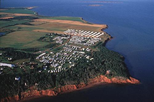
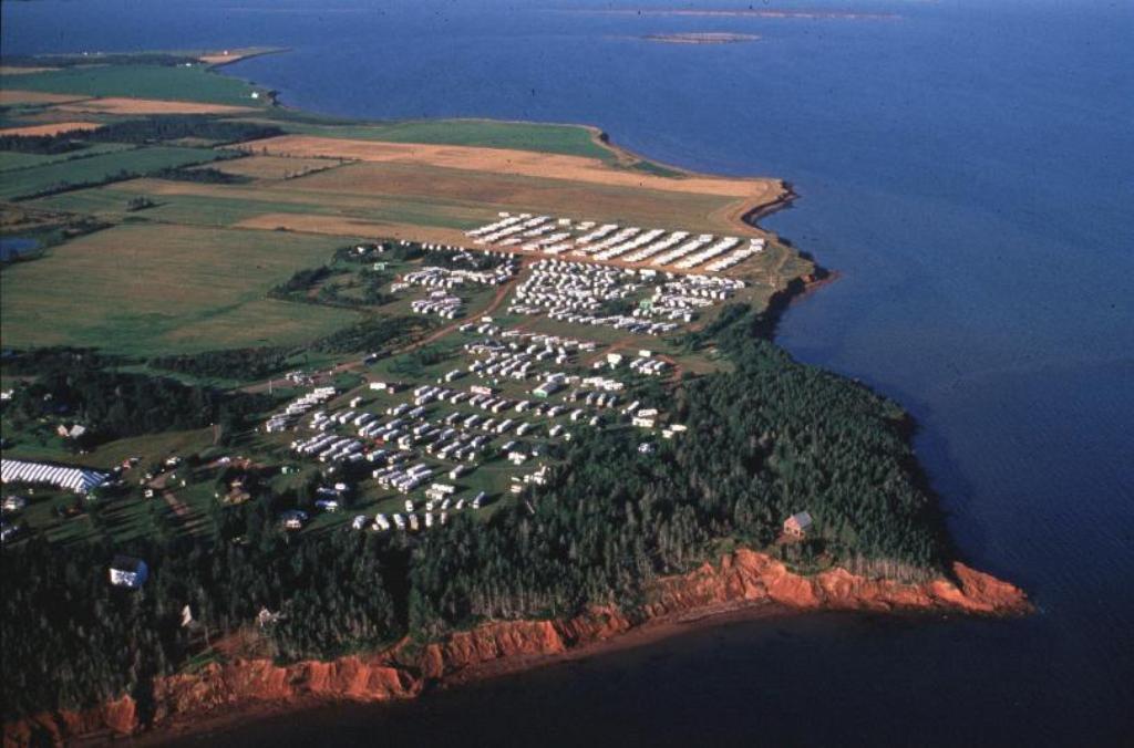
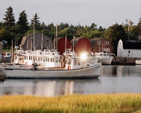
 | Aerial view of the FMCA 2000 Recreational Vehicle Rally at Cabot Beach Provincial Park. Credit: 2000 Tourism 500 x 330 - 30K 1024 x 676 - 88K |  | Malpeque Harbour Credit: 2006 James Devault (j.devault@att.net) 468 x 375 - 35K 959 x 768 - 112K |
| Visitors Guide Listings |
Our Visitors Guide is a complete vacation planning manual.
| The Geography of Malpeque |
Maps
You can use our interactive maps to
display maps of Malpeque and area.
Click on the map link:
Show Map
| Statistical Information |
Malpeque falls inside the Statistics Canada
census subdivision of Lot 18. They have detailed statistical information available
for the Lot 18 census subdivision for the following categories:
Education,Ethnicity,Family,Income,Labour Force,Population, and Shelter.
Information courtesy Statistics Canada.
| History of the Name |
The official history of the geographic name Malpeque (which can be somewhat technical, we admit):
Princetown (NOT Prince Town) (Village) was adopted 2 December 1901 on OBF 0142. Status changed to Settlement in Place Names of PEI, 1925.Status changed to Se ttlement in Place Names of PEI, 1925.Princetown (Sett.) NOT Malpeque (Princeto wn P.O.) (Sett.) was confirmed 2 August 1944 on 11L/12.(The Post Office Depart ment changed the P.O. name from Princetown to Malpeque on 16 November 1945).Na me changed to Malpeque (Sett.) 13 March 1947 on 11L/12.Status changed to Hamle t in 1960 Gazetteer.Status changed to Locality when Malpeque became part of th e Community of Malpeque Bay in 1973.
Information courtesy Geomatics Canada .