
PlaceFinder


HOME /
Ellerslie, an unincorporated area, is located in Prince County in the western portion of Prince Edward Island, NW. of Tyne Valley. Its precise location is N 46°36', W 63°57'.
This page is a comprehensive index of all of the information on our website related to Ellerslie. You can also search for information on other communities.
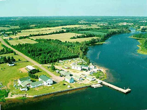
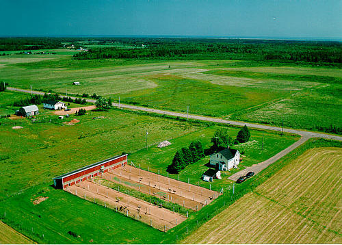
| Aerial Photographs |
Aerial photography courtesy of AirScapes. All aerial photographs are available for sale, as prints or slides; please contact AirScapes for details. You can also see a complete list of aerial photographs of the Island.
 | Ellerslie Harbour 640 x 480 - 40K 500 x 375 - 52K |  | Emu Farm 500 x 358 - 63K 711 x 510 - 151K |
| Visitors Guide Listings |
Our Visitors Guide is a complete vacation planning manual.
| The Geography of Ellerslie |
Maps
You can use our interactive maps to
display maps of Ellerslie and area.
Click on the map link:
Show Map
| Statistical Information |
Ellerslie falls inside the Statistics Canada
census subdivision of Lot 12. They have detailed statistical information available
for the Lot 12 census subdivision for the following categories:
Education,Ethnicity,Family,Income,Labour Force,Population, and Shelter.
Information courtesy Statistics Canada.
| History of the Name |
The official history of the geographic name Ellerslie (which can be somewhat technical, we admit):
Ellerslie (Sett.,P.O.) was adopted in Place Names of PEI, 1925. Ellerslie (Sett.) was confirmed 2 august 1944 on 11L?12.Status changed to Hamlet in 1960 Gazetteer.Status changed to Locality when Ellerslie became part of the Community of Ellerslie-Bideford in 1977. A settler named Wallace called his farm Ellerslie after Ellerslie, one of the manors of Sir william Wallace, the Scottish hero.
Information courtesy Geomatics Canada .