
PlaceFinder


HOME /
Annandale, an unincorporated area, is located in Kings County in the eastern portion of Prince Edward Island, SW. of Souris. Its precise location is N 46°16', W 62°25'.
This page is a comprehensive index of all of the information on our website related to Annandale. You can also search for information on other communities.
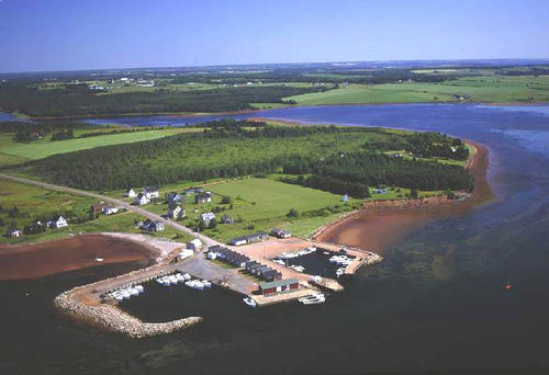
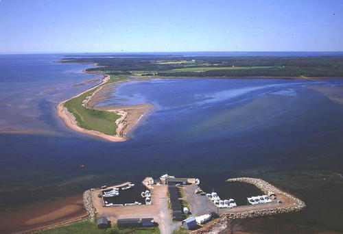
| Aerial Photographs |
Aerial photography courtesy of AirScapes. All aerial photographs are available for sale, as prints or slides; please contact AirScapes for details. You can also see a complete list of aerial photographs of the Island.
 | Harbour 500 x 342 - 36K 708 x 485 - 57K |  | Harbour 500 x 342 - 31K 708 x 485 - 47K |
| Visitors Guide Listings |
Our Visitors Guide is a complete vacation planning manual.
| The Geography of Annandale |
Maps
You can use our interactive maps to
display maps of Annandale and area.
Click on the map link:
Show Map
| Statistical Information |
| History of the Name |
The official history of the geographic name Annandale (which can be somewhat technical, we admit):
Annandale (Village) was adopted in Place Names of PEI, 1925. Annandale (NOT Anandale)(Sett.) was adopted 7 January 1947 on 11L/8. Confirmed 8 July 1948 on c. 4421.Status changed to Hamlet in 1960 Gazetteer.Annandale (Hamlet) NOT Annandale Lot 56 (P.O.) was confirmed 4 January 1967 on 11L/8.Status changed to Locality when Annandale became part of the Community of Annandale-Little Pond-Howe Bay in 1975. "Name given about 1868 in deference to James Johnston, who was born in Annandale, Dumfriesshire, Scotland in 1837.He began business here in 1855 when it was known as Grand River Wharf.It was not until 1876-7 that the name annandale became general in use."- PN of PEI, 1925.
Information courtesy Geomatics Canada .