
PlaceFinder


HOME /
Naufrage, an unincorporated area, is located in Kings County in the eastern portion of Prince Edward Island, NE. of St. Peters. Its precise location is N 46°28', W 62°25'.
This page is a comprehensive index of all of the information on our website related to Naufrage. You can also search for information on other communities.
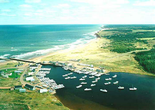
| Aerial Photographs |
Aerial photography courtesy of AirScapes. All aerial photographs are available for sale, as prints or slides; please contact AirScapes for details. You can also see a complete list of aerial photographs of the Island.
 | Naufrage Harbour 701 x 499 - 39K 500 x 355 - 44K |
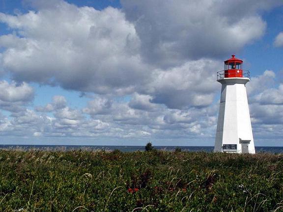
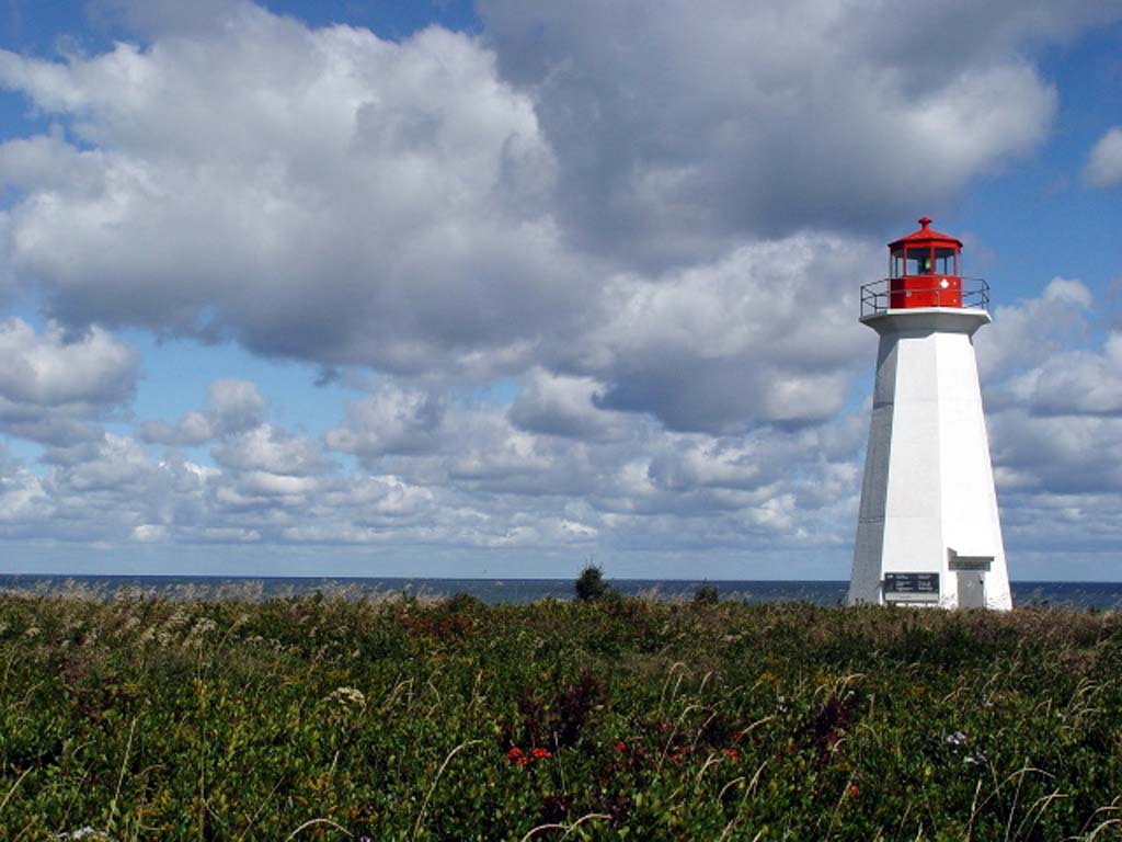
| Community Photographs |
Our community photographs collection includes selected photos of schools, churches, parks, and other public buildings, areas and events. .
 | Naufrage Harbour Credit: 2000 Darin Foulkes 500 x 332 - 29K 1024 x 680 - 152K |  | Lighthouse Credit: 2006 Earle Dunphy (ipe157@comcast.net) 576 x 432 - 59K 1024 x 768 - 106K |
| Visitors Guide Listings |
Our Visitors Guide is a complete vacation planning manual.
| The Geography of Naufrage |
Maps
You can use our interactive maps to
display maps of Naufrage and area.
Click on the map link:
Show Map
| Statistical Information |
Naufrage falls inside the Statistics Canada
census subdivision of Lot 43. They have detailed statistical information available
for the Lot 43 census subdivision for the following categories:
Education,Ethnicity,Family,Income,Labour Force,Population, and Shelter.
Information courtesy Statistics Canada.
| History of the Name |
The official history of the geographic name Naufrage (which can be somewhat technical, we admit):
Naufrage (Sett.) was adopted 7 January 1947 on 11L/8.Confirmed 7 January 1947 on 11L/8.Status changed to Locality 23 October 1989 on 203-8.
Information courtesy Geomatics Canada .