
PlaceFinder


HOME /
Crapaud, a village, is located in Queens County in the central portion of Prince Edward Island, N. of Victoria. Its precise location is N 46°14', W 63°30'.
This page is a comprehensive index of all of the information on our website related to Crapaud. You can also search for information on other communities.
| Municipal Government Information |
The Municipality was incorporated in 1950 and has a population of 345.
| Telephone: | (902) 658-2558 |
| Address: | PO Box 30, Crapaud, PE, C0A 1J0 |
| Meetings: | First Tuesday of the month at 7:00 p.m. This information is subject to change. Please contact the municipality to confirm the meeting time and location. |
| Office Hours: | Wednesday 1 p.m. - 5 p.m. & 6 p.m - 8 p.m. |
| Email: | crapaudadmin@pei.aibn.com |
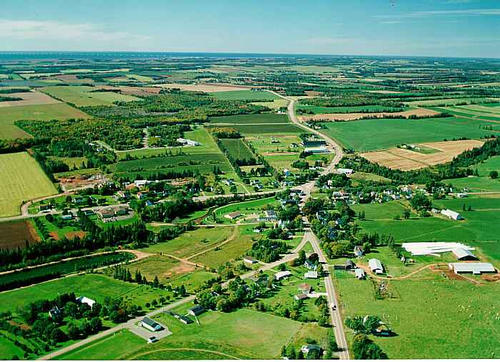
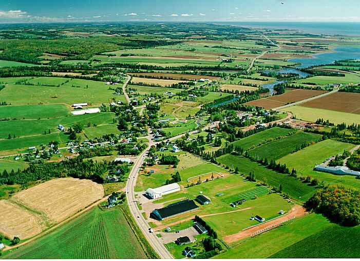
| Aerial Photographs |
Aerial photography courtesy of AirScapes. All aerial photographs are available for sale, as prints or slides; please contact AirScapes for details. You can also see a complete list of aerial photographs of the Island.
 | Crapaud 701 x 508 - 60K 500 x 362 - 65K |  | Crapaud 701 x 508 - 61K 500 x 362 - 67K |
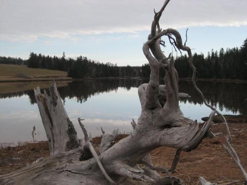
| Community Photographs |
Our community photographs collection includes selected photos of schools, churches, parks, and other public buildings, areas and events. .
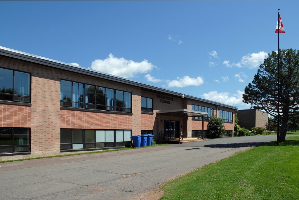
 | Gnarled tree overlooking water Credit: 2009 Stella Hagen 500 x 375 - 27K 1024 x 768 - 95K |  | Englewood Elementary Credit: 2007 Province of Prince Edward Island 640 x 428 - 194K 1024 x 685 - 478K |
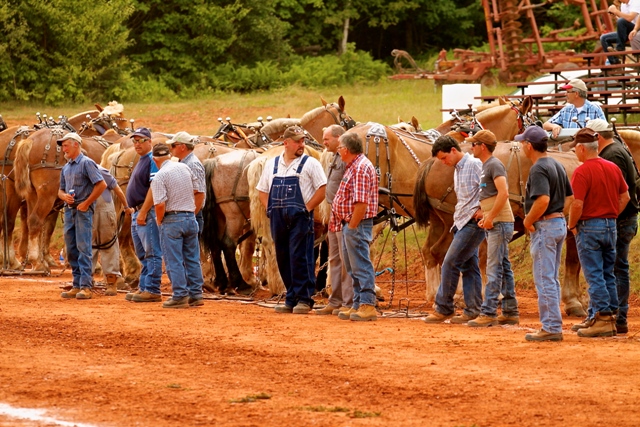
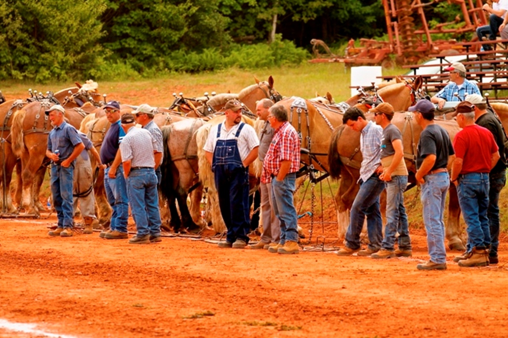
 | Crapaud Exhibition Credit: 2012 Stclair Mac Aulay Arlington 427 x 640 - 148K 683 x 1024 - 272K |  | Crapaud Exhibition Horses Credit: 2012 St Clair MacAulay Arlington 640 x 427 - 219K 1024 x 683 - 397K |
| Visitors Guide Listings |
Our Visitors Guide is a complete vacation planning manual.
| The Geography of Crapaud |
Maps
You can use our interactive maps to
display maps of Crapaud and area.
Click on the map link:
Show Map
| Statistical Information |
The PEI Community Accounts has information about Crapaud. Community Accounts provides a comprensive source of community, regional, and provincial data on social, environmental and economic topics
Information courtesy of Community Accounts
Crapaud falls inside the Statistics Canada
census subdivision of Crapaud. They have detailed statistical information available
for the Crapaud census subdivision for the following categories:
Education,Ethnicity,Family,Income,Labour Force,Population, and Shelter.
Information courtesy Statistics Canada.
| History of the Name |
The official history of the geographic name Crapaud (which can be somewhat technical, we admit):
Crapaud (Sett.) was adopted in Place Names of PEI, 1925. Confirmed 12 December 1939 on 11L/3.Status changed to Village in 1960 Gazetteer.Status changed to Community in 1950. The name Crapaud which means "frog" comes from the French name of Brocklesby River (now Westmoreland River) - riviere aux Crapauds. - Place Names of PEI, 1925.
Information courtesy Geomatics Canada .